The average driver spends 2.5 hours a day waiting at facilities, detention touches roughly 40% of truckload stops, and it drains the industry more than $15 billion a year — yet only about 29% of carriers actually collect the detention they're owed. The reason is almost always the same: nobody can prove when the truck arrived. Carrier and facility timestamps disagree, gate logs are unreliable, and the dispute ends in a write-off. Geofencing fixes the root cause by turning every arrival and departure into a GPS-verified timestamp the moment a truck crosses a boundary — automatic detention, dwell, and billing data with no phone calls. This guide shows how geofencing works across terminals, yards, and customer sites, and how it surfaces the dwell problems quietly bleeding your fleet. Start geofencing your sites free.
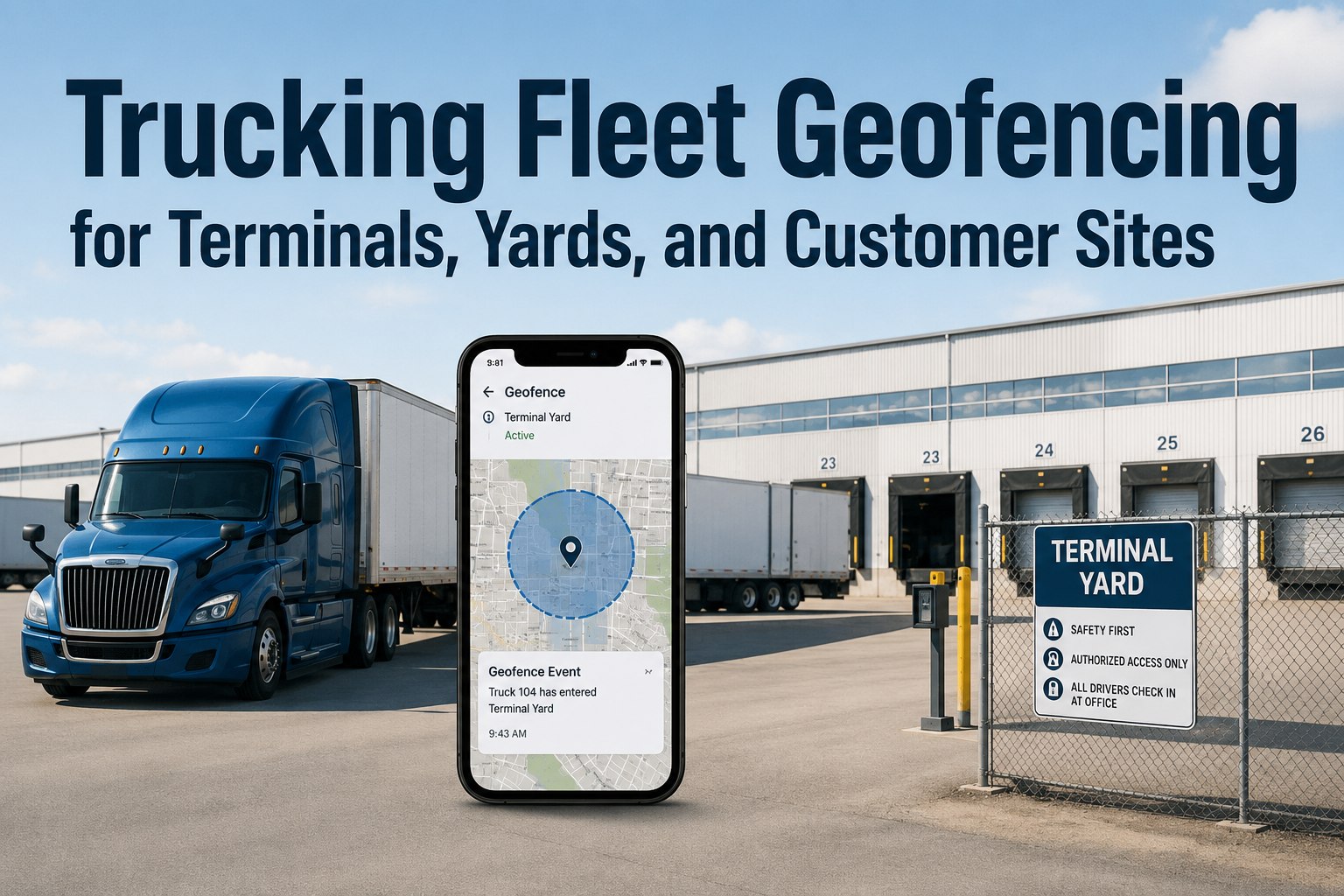
Trucking Fleet Geofencing for Terminals, Yards, and Customer Sites
Geofencing turns arrivals into automatic detention, dwell, and billing data. Cut manual tracking and surface the dwell problems hiding at your customer sites — with a GPS record no one can dispute.
The Problem Geofencing Solves
Fleets don't lose money in dramatic ways — they lose it in small, repeated delays nobody records. A truck arrives and no one logs it. A trailer sits longer than expected. A driver burns HOS waiting for a dock. By the time the customer calls, the day is already gone. Here's the scale of what's leaking.
How a Geofence Turns Arrival Into Data
A geofence is a virtual boundary around a real location. The moment a tracked truck crosses it, the system timestamps the event — no driver input, no dispatcher watching a screen. That single crossing kicks off a chain of automatic actions that used to take phone calls.
Three Places Worth Fencing First
Geofences should be tied to decisions, not curiosity. These three location types create the most friction for trucking fleets — start here, where a timestamp actually changes what you do next.
Automated proof of when vehicles leave and return. Add an after-hours movement alert for security, and a dwell alert if trucks sit too long before dispatch. Cuts trailer-hunting and unauthorized departures.
Solves the "it was there yesterday" problem. Know which trailer sits in which slot, how long it's been staged, and get an instant alert if an asset moves over a weekend or overnight.
Fence the 5–10 sites with the most dwell or schedule volatility. Real arrival and departure timestamps build the case for detention billing and expose which customers cost you hours.
Fence the Sites That Cost You Most
Truck Inspection & Maintenance logs arrival, dwell, and departure at every geofenced terminal, yard, and customer site — turning waiting time into a documented, billable record.
Why Polygon Beats a Circle
The shape of your geofence decides whether your data is trustworthy. A wide circular radius can ping "arrival" while the truck is still a mile out — making true dwell impossible to calculate. A polygon that traces the actual property line records the crossing at the right moment.
What the Dwell Data Reveals
Once arrivals and departures are timestamped, patterns surface fast. The value isn't a single number — it's seeing that one site eats hours while another runs clean, then doing something about it. That comparison is leverage in your next rate conversation.
When Site A averages 2 hours to unload and Site B does 45 minutes, you can adjust appointment times, re-price the lane, or bill detention with proof.
A dwell alert flags an abnormal wait while the driver is still on site — early enough to react, not after the day is already blown.
A GPS-verified arrival and departure record ends the "your timestamps don't match ours" argument and speeds detention settlement.
An after-hours movement alert shrinks the time between an unauthorized asset move and detection — when most yard theft happens.
Avoiding Alert Fatigue
The fastest way to make geofencing useless is to alert on everything. If dispatch gets a ping every time a truck pulls into the home yard on a Monday, they'll learn to ignore all of them. Tie alerts to decisions, not events.
Frequently Asked Questions
When a tracked truck crosses a facility geofence, the system timestamps arrival, starts the free-time clock, and timestamps departure on exit — creating a GPS-verified record of exactly how long the truck was on site. That indisputable evidence ends the timestamp arguments that cause most detention write-offs, where only about 29% of carriers currently collect what they bill.
A circular geofence is a simple radius — fast to draw but imprecise, often pinging "arrival" while a truck is still a mile away and triggering false alerts at neighboring facilities. A polygon traces the actual property boundary, so entry and exit are recorded at the right moment. For accurate dwell and detention data, especially at tight yards or shared industrial parks, polygons are worth the extra setup.
Start with your own terminal for proof of vehicle comings and goings, add high-value yards and drop lots to solve trailer-location problems, then fence the 5–10 customer sites where dwell or schedule volatility is worst. A good rule: only fence locations where a timestamp will actually change a decision — fence actions, not curiosity.
Facilities using automated geofence check-in report 15–25% reductions in average dwell time, which translates directly to more loads per driver per week and lower detention exposure. The savings compound: less waiting means less HOS burned, fewer detained drivers speeding to make up time, and a stronger position when renegotiating rates with chronically slow sites.
It removes the manual work and the noise. Truck Inspection & Maintenance lets you draw polygon geofences around your terminals, yards, and customer sites, then logs arrival, dwell, and departure automatically, calculates detention against your free-time window, and sends filtered alerts only when something needs a decision — turning location data into billing records and dwell insights without a dispatcher watching a map.
Turn Every Arrival Into a Billable Record
Truck Inspection & Maintenance draws polygon geofences around your terminals, yards, and customer sites, timestamps every arrival and departure, auto-calculates dwell and detention, and surfaces the sites quietly costing you hours — so you bill what you're owed and fix what's slow.